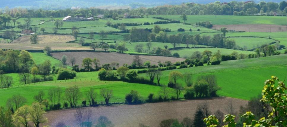
Landscape structures (land use, hedges, marshes, etc.) and farming practices (soil tillage, cover crop …) can accelerate or buffer contaminant-laden water flows in a watershed. These flows are controlled on scales that go beyond the plot and the farm, but there is a lack of landscape engineering tools to assess the cumulative effects of these complex structures within a watershed. The TIP TOP project analysed and modelled the transfer of these flows (water, nitrogen, phosphorus, carbon, faecal bacteria, soil particles) in agricultural watersheds, in order to better predict and control them through agroecological practices aimed at optimising the landscape’s buffering potential.


The TIP TOP project has two major objectives:
- The construction of a spatial/landscape modelling tool, developed with local stakeholders. This should enable the evaluation of prospective scenarios by modifying parameters such as existing cropping systems (crop rotations, agricultural practices) and the location of landscape elements.
- Promoting an ecological transition of agricultural landscape areas using a participatory approach to help better design the agricultural landscape and optimise its positive impact on water resources.
Our interest in such a project is to support the operational development of tools for local stakeholders and farmers committed to the agroecological transition, and then to promote these innovations from both a scientific and educational point of view.
Our experimental approach
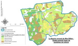
Tip-Top uses participatory modelling approaches involving farmers and other local stakeholders to create a knowledge base on the organisation and use of agricultural landscapes. It involves surveying farmers to establish a typology of cropping systems present, and working with local experts to describe wetlands and landscape buffers and their management. These data are then integrated into a geographic information system (GIS) to feed the OPALE simulator (Trevisan et al, 2022).
This modelling tool has three components:
- “Landscape construction” (simulation of a mosaic of crops (in space) linked to a cropping itinerary as a function of the cropping system (in time))
- “Nutrient/particle production” (modelling of water dynamics and nutrient emissions) and finally
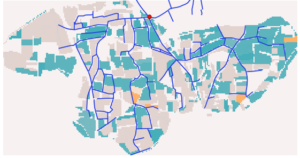
- “Nutrient/particle transfer” (modelling of their trajectories and residence times as a function of landscape hydrological connectivity).
The models were built on three pilot sites with different landscapes and agricultural practices: the Lac d’Aiguebelette watershed (Savoie district), the Val de Méaudre (Isère district) and a market-gardening area in Miribel (Ain district). Our team was particularly involved in supporting the local stakeholders, creating the crop and land use typology, monitoring the soil erosion and contributing to the conceptual and technical aspects of the OPALE tool.
The aim is to build agricultural scenarios that enable the development of adaptations and innovations. The benefits for water resources are not visible at plot level, hence the interest in developing an analysis at the level of the small agricultural watersheds, with an operational GIS tool for assessing cumulative effects from “plot to landscape”. We can then better apprehend and discuss the impact of adaptations proposed by stakeholders and researchers on the sustainable conservation of water resources at a territorial scale.
Current state of the project
The project will develop an operational simulator OPALE (Operational assessment of landscape water eco-functionalities, Environmental Modelling & Software) which effectively reproduces the probable trajectories of particles in the watershed and compares different agricultural and landscape scenarios. Although the tool is still difficult for managers to get to grips with, the results are encouraging, with a view to use it to collectively build management scenarios and compare probable effects for decision-making purposes.
Project team
Benoit Sarrazin, Mathieu Guérin (Agroecology and Environment research unit).
Partners
Research partners: INRAE (Thonon-les-Bains), ISARA , University of Grenoble, University of Rouen.
Local stakeholders involved: Communauté de communes du lac d’Aiguebelette, Communauté de communes de Miribel plateau, Vercors Regional Nature Park, Conservatoire d’espaces naturels Rhône-Alpes.
Learn more about the project
Dominique Trevisan, Claude Janin, Patrick Taillandier, Benoit Sarrazin. PSDR4 TIP TOP – Un outil sur les paysages agricoles, l’eau et la transition agroécologique. Innovations Agronomiques, 2022, 86, pp.123-136. 10.17180/ciag-2022-vol86-art12.
Trévisan, D., Taillandier, P., Sarrazin, B., Etienne D., Ayari, N., Petiqueux, C., Quétin, P., Janin, C. OPALE: Operational assessment of landscape water eco-functionalities, Environmental Modelling & Software, Volume 148, 2022, 105276, ISSN 1364-8152, https://doi.org/10.1016/j.envsoft.2021.105276.
